Kastania of Samos

🌳 Kastania of Samos – The village of chestnut trees and history
📍 Location & Access
Kastania is located in northwestern Samos, on the northeastern foothills of Mount Kerkis, on the eastern slope of the hill called “Fteria”, surrounded by lush vegetation. The distances from key points on the island are:
🛣️ 41 km from Samos Town
🛣️ 10 km from Karlovasi
🛣️ 34 km from Pythagoreio
🛣️ 6 km from Marathokampos
🌄 Altitude & Natural Beauty
Built at an altitude of approximately 350 meters, the village offers excellent views toward Karlovasi and the coast of Asia Minor. The landscape is lush, with chestnut trees dominating the scenery and creating a magical atmosphere for visitors.
🏘️ Architecture & Central Square
The architecture of Kastania features traditional stone houses with tiled roofs. In the central square, a centuries-old plane tree offers shade and coolness, while the public fountain with its crystal-clear water is a favorite stop for both locals and visitors.
⛪ Church of the Dormition of the Virgin
The village church, dedicated to the Dormition of the Virgin Mary, was built in 1902 and inaugurated on September 28, 1924. It is built in the basilica style and is a spiritual center for the community.
🎉 Festival & Local Celebrations
Every year on August 24, the village hosts a major festival celebrating the Dormition of the Virgin. Visitors can experience authentic local tradition, complete with music, dancing, and homemade delicacies.
🍇 Economy & Agricultural Life
The economy of Kastania is primarily based on agriculture, focusing on vineyards, olives, and vegetables. The villagers cultivate their land with care, preserving the agricultural legacy of the area.
🕰️ Historical Notes
The first known reference to Kastania appears in a 1613 land agreement. During the Italian occupation in World War II, the village suffered heavy losses: on August 30, 1943, 27 villagers were executed by the occupying forces in retaliation for local resistance efforts. A memorial has been erected at the execution site, where a commemorative service is held every year.
🏛️ Recognized as a Place of Martyrdom
In 2024, Kastania was officially recognized by the Greek state as a "Place of Martyrdom", honoring the sacrifice of its people during the years of occupation.
📸 Suggested Images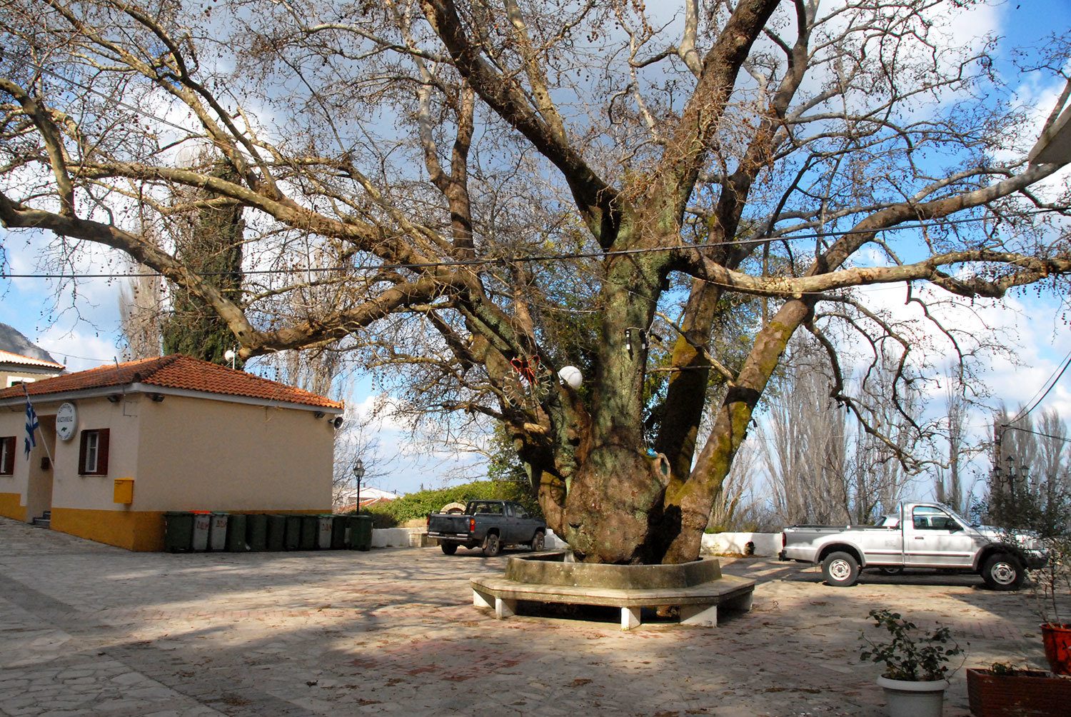
📷 Panoramic view of the village with Karlovasi in the background
📷 The central square with the old plane tree
📷 Church of the Dormition of the Virgin
📷 Traditional stone houses and narrow alleys
📷 The memorial for the fallen villagers
📷 Vineyards and olive groves surrounding the village
Add new comment